Data Validation
Data Validation Software
Independent Verification & Data Validation Software
- Data accuracy is important
- Accurate geospatial data are important:
- applications
- management of assets
- quality of provided services
- Quickly assess the quality and accuracy of your orthophoto, DEM or LiDAR data, using a standardized, consistent process.

Data Accuracy Tools are Important
- Spatial accuracy
- Feature/attribute accuracy
- Photogrammetric accuracy
- Route accuracy for GNSS navigation applications
- Organizational accuracy (i.e. naming conventions, domains, duplicate values, topologies and networks)
- Geometric accuracy
Data Verification Certifies Your Existing Data Set is Accurate
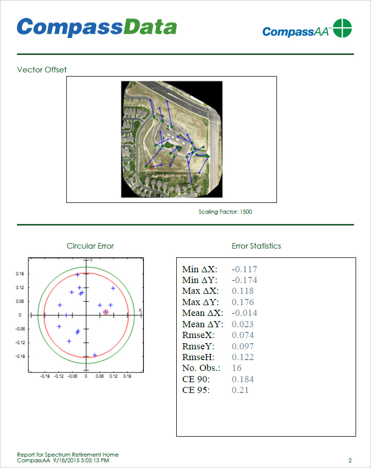
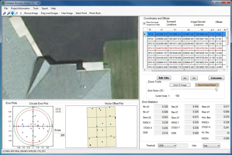
CompassAA™ and CompassTA™ are GIS tools to ensure the accuracy of field data, as well as to verify the accuracy of any pre-existing geospatial datasets.
CompassAA™ and CompassTA™ promotes excellence and agility for your independent QA/QC.
Data accuracy tools are important.
Ensure Spatial Accuracy in your GIS Data Kit
CompassAA™ is a simple, fast, and complete workflow solution to verify the accuracy and quality of orthophotos.
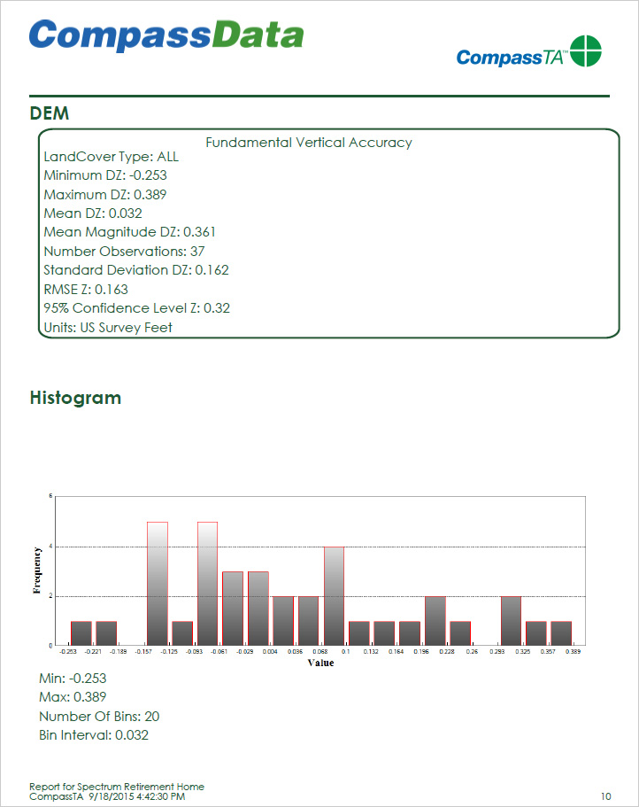
CompassTA™ is a simple, fast, and automatic solution to verify elevation data products and test LIDAR point cloud data.