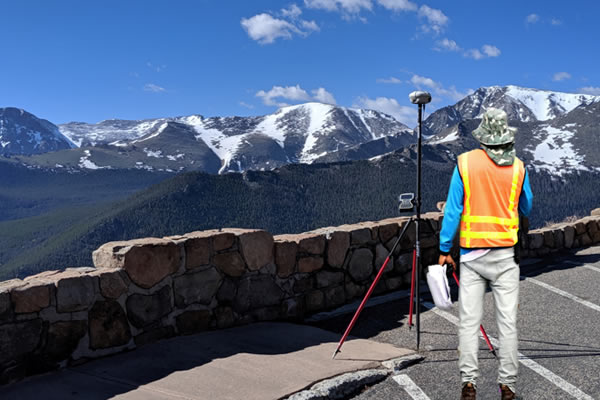
 Ground Control Survey
Leader in providing Global Ground Control Points (GCP) Survey data for remotely sensed data by satellites and other GIS applications.
- Archive of 80,000+ Ground Control Points GCPs
- Standardized Ground Control Points (GCP) Delivery from anywhere in the world
- FAA / ISO 9001:2015 certified Quality Management System
- Repeatable accuracy for Ground-Truthed GeoData
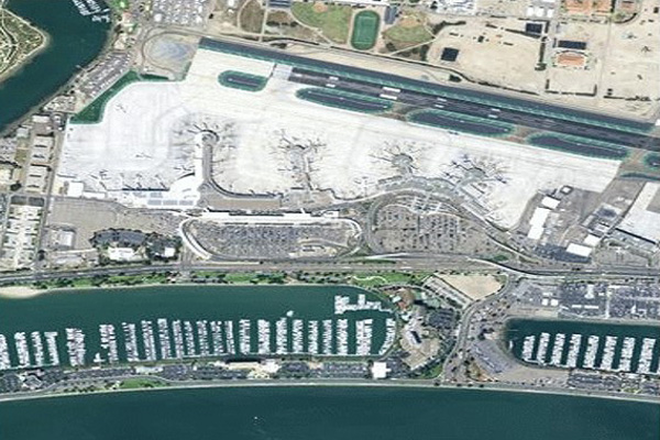
 Aerial / Drone Imagery
Leveraging the latest technology, we offer low-cost aerial data acquisition solutions fitting your specific needs:
- Focused sensor solutions to achieve specific project results (RGB, Thermal)
- Imagery: Aircraft and Drone collection options
- Archive Imagery or New Collection available
- Survey grade orthorectified imagery, Digital Surface Models
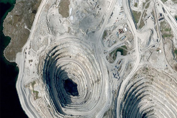
 Satellite Imagery
With access to several sensors and a one of a kind accuracy we enhance your dataset providing real world answers from high resolution imagery:
- Submeter accuracy using our survey Ground Control Points (GCPs)
- Rapid access to off the shelf imagery archive
- Customizable solutions meeting your primary AOI
- Quality product generation using certified processes
LiDAR Data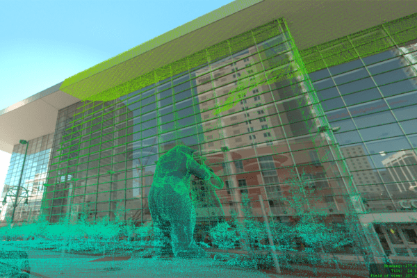
Customized Source Platform Meeting Your Development Requirements:
- Completely scan your AOI at the highest accuracy
- Aerial collection: Aircraft or Drone
- Ground collection: Vehicle or Backpack
- Extract key elements through classification to share your data within your organization
Mobile Mapping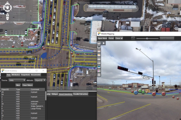
Rapidly geospatial data collection with attribute rich metadata and embedded images to multiple markets:
- 360 degree or planar imagery, and point clouds
- Attribute rich datasets for asset management bringing GIS to life
- Cost-effective approach to map and manage assets
- Quickly deliver accurate data